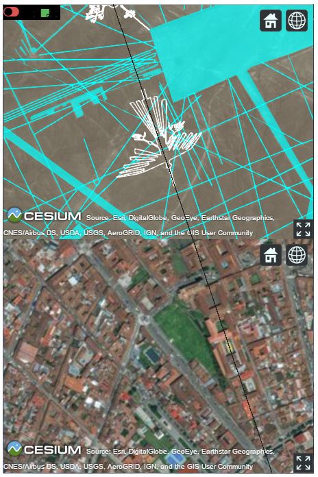
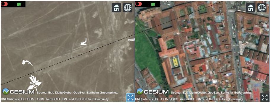
The following table shows the facts we should consider before creating any hypothesis.
The Proven Facts About Nazca Lines
| Variable | Nazca Lines Facts |
|---|---|
| Location: | Nazca and Palpa in Peru (-14.716667, -75.133333) |
| Culture Type: | Nazca and Paracas |
| Authenticity: | Indisputable |
| Age: | Nazca(500 BCE- 500 CE) and Paracas (800-100 BCE) |
| Minimum Age: | 100 BCE |
| Easy To Draw: | Just remove the superficial red iron oxide layer |
| Difficult to See: | Only partial view from e hills. Most can only be fully contemplated at higher altitudes. |
| Easy To Erase: | Just a little rain woud erase all lines |
| Difficult to Explain: | Several concurrent theories. Multi-purpose system. |
| Early Mentionned: | by Pedro Cieza de León in 1553 |
| First Analysis: | by archaeologist Toribio Mejia Xesspe in 1926 |
| Public Awareness: | 1930's with the appearance of commercial airlines |
| Extensive Analyis: | Paul Kosok (1939-1949) and Maria Reiche (1941-1998) |
| Practice: | Elongated Cranium |
| Other Constructions: | Cahuachi Pyramid and Cantalloc Aqueducts |
| Electronic Iteractive Map: | Geekglyph 2012 (Google Earth - KLM) and Geekglyph 2017 (Cesium-CZML) |
| Basic Composition: | Geometric shapes (Trapezoids), Lines and Figures (Icons) |
| Number of Icons: | So far, around 48 icons, from which 12 are birds. |
| Not unique phenomena: | Candelabro de Paracas, Band of Holes, Atacama Giant, Morro de Arica, Chiza, Tiliviche, Cerro Pintados |
| The Central Icon | It is undoubtedly the Condor |
| Main Surviving Culture | Incas. The Incas possibly inherited part of Nazca culture knowledge, mainly Ceque System. |
| Main Belief: | Cuzco was considered the Center of the World, from which emanated the straight lines - ceques |
| Cartography: | Inca Monoliths Sayhuite Stone in Abancay and Kenk Stone near Cuzco depict a map |
| Hydrographic: | Figures have hydrographic meaning. Of course, they were in the desert where the most precious element is water. |
| Possible Foreign Contacts: | Pokotia Monolith and Magna Bowl (controversial), having Sumerian inscriptions. |
| Contemporary of Sumerians | Nearby big site Caral was carbon dated +2627 BCE, Sumer Early Dynastic Period I sfrom 2900 BC |
Just these facts allow us to draw some basic conclusions:
1- The lines were drawn to last. The people who build them had advanced knowledge of climatology. They chose a never rain region.
2- The Aqueducts probably had double purpose: keep some areas dry by lowering the underground water table and provide gardens for subsistence
3- The lines were built to be seen by their gods or flying entities. It is a message to the Gods or Flying Beings.
4- By the size of the area (170 sq mi)), the message seem to be very important.
And from these basic conclusions we can delineate the Main Hypothesis:
The Lines reflect some kind of Proto Ceque System and, as such, they have multiple purposes: astronomic, calendric, religious, geographic, historic, numeric, linguistic, political and social.
The basic proof we give to sustain such hypothesis is: The direction of the main Ceque, Cuntisuyu, originated from the Qurikancha in Cuzco perfectly matches the direction of the Condor and The Big Rectangular Plataform next to the Condor has heading 69.34 degrees, which ends exactly in the Qurikancha.


Our Secondary and more speculative hypothesis is that Nazca is a Map of the World.
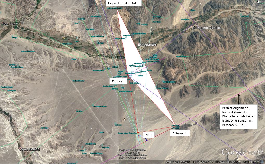
The basic assumption sustaining such hypothesis is that the Icons are grouped in geo-astronomic headings: 6.5, 23.5, 63.5 and 72.5. Also the Central Icon (Condor) matches the ceque system.
If the central icon is in effect the Andes east of Nazca, then the whole system should be rotated 72.5 degrees and scaled Nazca Max Length 60 Km divided by Earth Circumferece approx. 40000 km => Scale 40000/60 = 666.666.
As a matter of fact Nazca basic geometry is defined by a isosceles triangle, where the distance from the condor to the astronaut icons is the same as the distance from the condor to the palpa hummingbird icon, making an internal angle of 2x72.5=145 degrees.
Strangely, the astronaut icon is perfectly aligned to the center of Khafre Pyramid and Ahu-Tongariki, defining a 30 degree vertex Great Circle. This alignment was studied by Jim Allison. The most simple explanation is that as civilizations developed along the Delta of big rivers, their centers are aligned just because the Deltas are aligned by nature. By coincidence the vertex is next to Giza, which is the historial prime Meridian. So, this wonder may have 2 undeniable characteristics: East-West line from prime meridan civilization and delta at 30 degrees latitude North.
The Armillary sphere also depicts the Great Circle at 23.5 degrees, which is the Ecliptic, in the shape of a ribbon or plane. Erathostenes invented this sphere and also measured the Earth in circa 250BC based on the distance from Aswan (old Syene - 24 degrees North) and Alexandria (31), which is the same distance distance from the Great Pyramid to the average Tropic of Cancer (22-24 degrees, avg 23). Both differs from 7 degrees, leading to the same pattern: 15-22-29, 16-23-30 and 17-24-31.
The results are summarized in the table below. A better vizualization can be performed straight in our app, where we present the icons, the projections and the meanings side-by-side.

Nazca Icon and Projection Analysis
| Type | Icons | Heading | Nazca World Map | |||||
|---|---|---|---|---|---|---|---|---|
| Icon | Projection | coord | geodetic match | physical match | historical match | Match Quality | ||
| Calendric | Calendar | -6.5° | 72.5° | 23.3°,-48.1° | Tropic of Cancer | Kane fracture zone | Pirireis 23.5°, -42.6° | A |
| Spider | -6.5° | 66.0° | -14.5°,-69.7° | Lake Titicaca (north part and shape) | B | |||
| Key | -6.5° | 66° | -9.3°,-71.4° | Purus River | C | |||
| Liz Flower | -49° | 23.5 | -12.4°,-71.3° | Delta Alignment | Madre de Dios | Cuzco-Pisac direction | B | |
| Fan | -96° | -23.5° | -1.4°,-71.9° | Equator | Pucumayo-Amazon river | A | ||
| Equinoctial | Hummingbird | 23.5° | 96.0° | 0.6°,-73.2° | Equator | Caquetá-Japurá-Amazon river | Shamanic symbol | A |
| Snowflake | -47° | 60° | 37.6°,18.6° | Gulfs of Patra and Corinth | Delphi, Olympia and Mycenae | B | ||
| Palpa Pelican | 47° | 145° | 39.0°,17.1° | Gulf of Taranto | Magna Graecia | A | ||
| Moa | 235° | 47° | -60.3°,154.6° | Polar Front | Macquarie Island pointing to New Zealand | B | ||
| Trapezoid Bird | 47° | 145° | 35.6°,-0.2° | Greenwich | Lake Oran - Atlas Mountains | El Bayadh | A | |
| Precessional | Astronaut | 72.5° | 156.5° | -46.8°,-100.4° | 2x Tropic Capricorn Latitude | Complex: See Full Analysis | Easter Island | A |
| Condor | 72.5° | 145° | -12.9°,-72.3° | Delta Alignment | Sacred Valley | Machu Picchu | A | |
| Palpa Hummingbird | 72.5° | 145° | 7.5°,-36.8° | Delta Alignment | Vernadskiy Fracture zone | B | ||
| Parrot | 72.5° | 145° | -21.7°,-64.0° | Tarija and Tariquia | B | |||
| Harmonic | Flower | 90° | 162.5° | -16.6°,-68.7° | Lake Titicaca (south part). Sajama flower of volcanos(dir). | Akapana Pyramid | A | |
| Eagle | -90° | -17.5° | 10.9°,-55.9° | 2D Alignment | Orinoco- Corentyne Deltas | La Blanchisseuse | B | |
| Tumi Knife | 120° | -96° | 44.9°,44.6° | Kuma River and Volga Delta | C | |||
| Checkboard | 0° | 23.5° | 72.4°,-144.9° | 1/4 North Pole to Tropic of Cancer | Beaufort Sea | A | ||
| Solar Clock | 0° | 107.5° | 39.0°,43.3° | Longitude of Vertex of Delta Alignment | Lake Van (Solar Clock),Lake Sevan (Monster), Lake Urmia (triple spiral) | Urartu | A | |
| Referential | Monkey | 63.5° | -44° | -7.5°,-80.0° | Peruvian North Point (Isla Lobos de Tierra and Islas Lobos de Afuera) | Chan Chan , Otuzco, Cumbe Mayo, Kuntur Wasi, Tucume Pyramid, Huaca del Sol | A | |
| Lizard | 63.5° | 136° | -19.0°,-67.2° | Lakes Poopo-Ururu | Possible Atlantis (Jim Allen) | A | ||
| Hands | 63.5° | 136° | -19.2°,-68.2° | Lake Uyuni shape. | Aymara legends | A | ||
| Tree | 63.5° | 136° | -18.8°,-68.0° | Lake Uyuni tree stones formations. | Aymara legends | A | ||
| Fox | 127° | 199.5° | -12.0°,-78.3° | Isla San Lorenzo | Temple of the Fox, Markawasi, Caral, Chankillo, Chavin de Huantar, Pachacamac | A | ||
| Flamingo | 63.5° | 136° | -17.8°,-62.8° | Rio Grande-Gran Chaco | B | |||
| Arrows | 63.5° | 136° | -23.8°,-56.5° | Tropic of Capricorn | Iguaçu Falls | B | ||
| Whale | -63.5° | 116.5° | -46.7,143.7 | 2x Tropic Capricorn | Tasmania. Shape of Australia-Papua. | Humpback Whale migration route | A | |
| Mandala | 63.5° | 116.5° | 56.5,-94.3 | North Pole and Tropic of Cancer middlepoint | Hudson Bay | B |